Traffic
Monitoring
Conduct your drone traffic monitoring operations with our advanced tethered solutions offering unlimited flight autonomy. Improve road safety, congestion management, and harness precise traffic data analysis to craft efficient traffic management plans.
Tethered Solutions for Drone Traffic Monitoring
[Use Case] How to conduct road traffic measurements in a major traffic hub city?
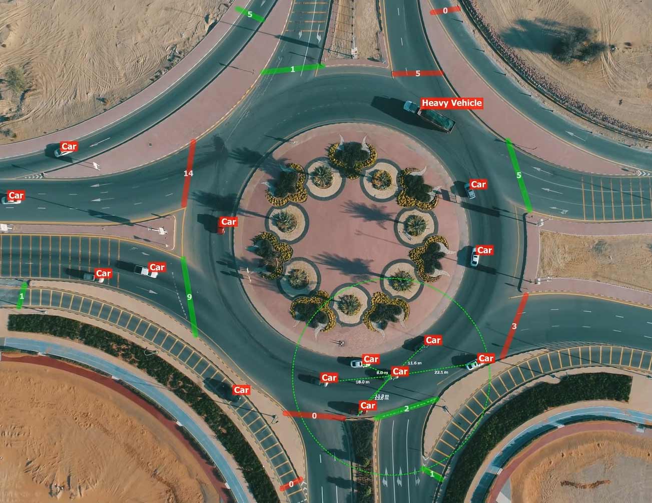
Roundabout Traffic Monitoring

5 gates to monitor

Need to identify vehicles nature and speed
3 hours monitoring needed
Elistair’s Traffic Drones Solutions
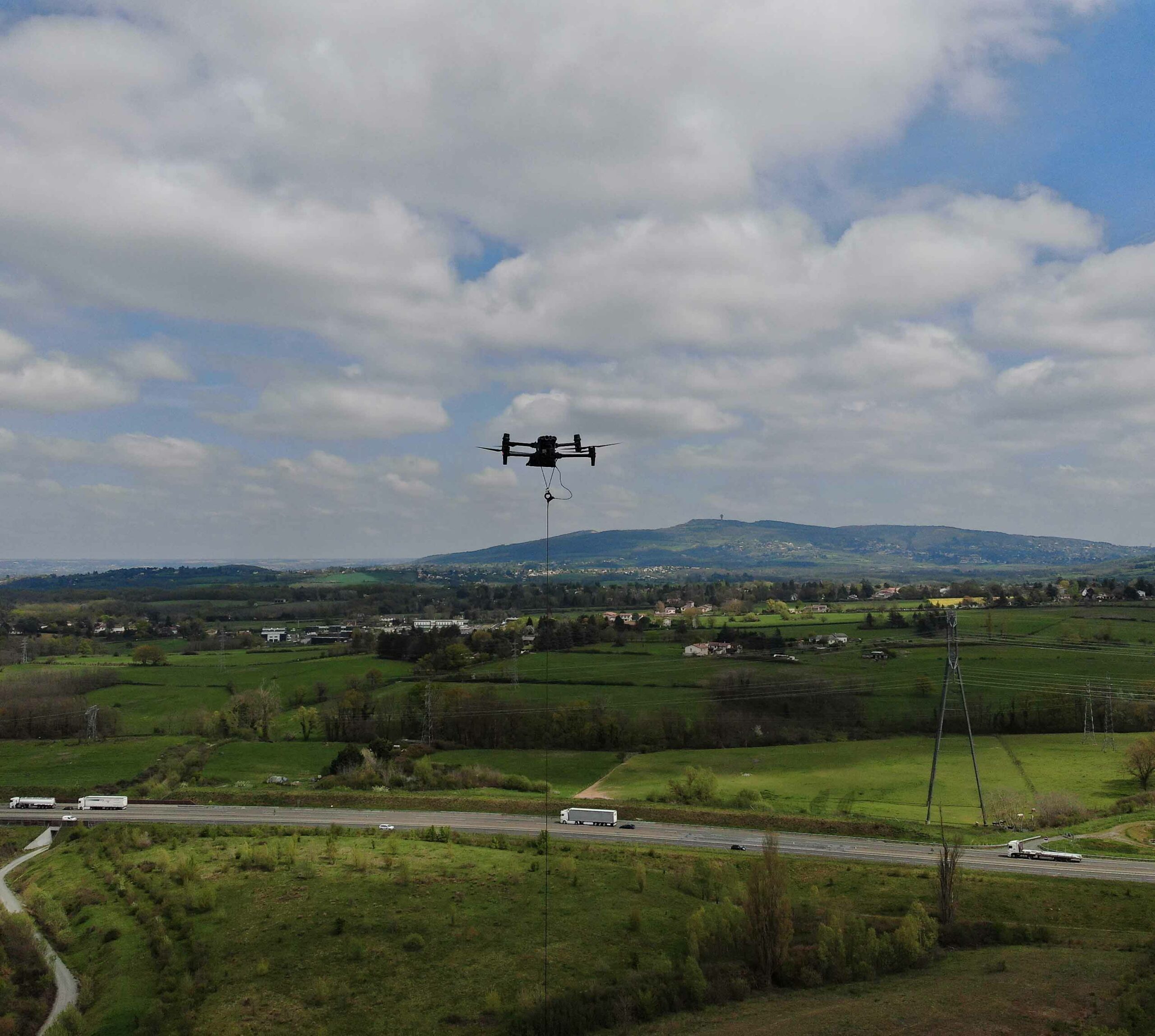
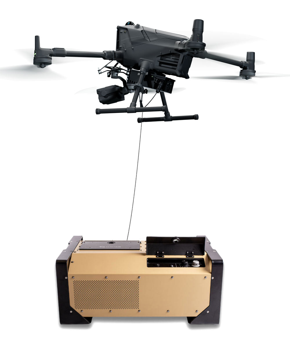
Tethered drones deployed as traffic monitoring devices offer continuous observation of major roadways or intersections without the need for battery changes or landing.
Positioned at heights of up to 100 meters, they provide precise vehicle surveillance for traffic data collection, road safety audits, or managing dense traffic during large events.
When integrated with traffic data analysis software, they become powerful tools for delivering real-time information, facilitating clear and prompt decision-making.
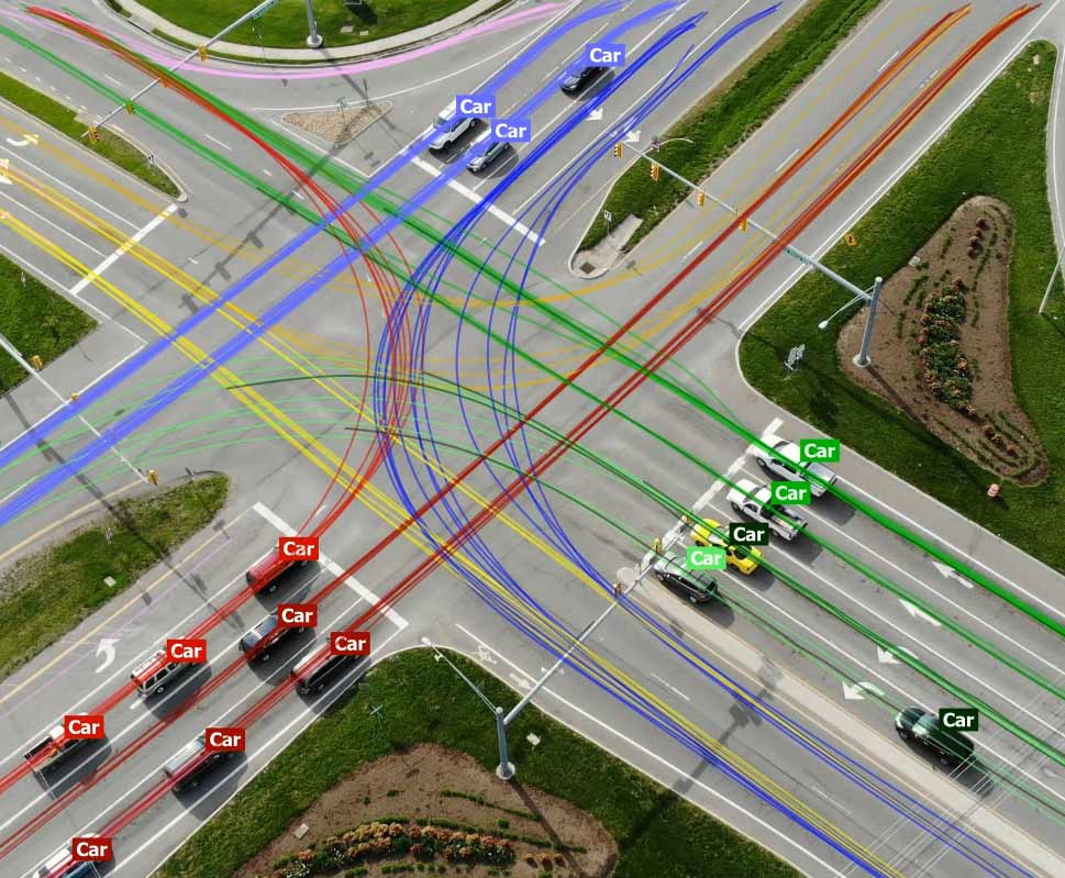
“Aerial traffic monitoring with drones has many advantages. It provides unique data such as complete origin-destination trajectories of large, complex traffic scenes but it can also deliver precise section speeds and gap times. Moreover thanks to tethered technology it is possible to monitor for longer periods to gather enough data to get a solid understanding of the traffic flow patterns, congestion points, and more.
A single tethered UAV combined with a video analysis software can hover steadily for several hours to count vehicles, identify their nature and speed, and provide a better understanding of traffic flow patterns, congestion points, and overall road conditions.”
Enhance traffic monitoring
with our solutions.
Drone Traffic Monitoring: Examples of Applications
Road Safety
Traffic drones are a highly complementary tool for road safety audits. Offering a panoramic view of traffic flows, these drones aid in identifying potential risks within infrastructures, enabling proactive measures to be taken.
In the event of an accident, traffic drones play a crucial role by swiftly providing real-time aerial images of the scene. This allows first responders to assess the situation rapidly and coordinate their interventions effectively, potentially saving lives and minimizing disruptions.
The aerial perspective provided by drones facilitates the observation of the accident’s immediate impact on surrounding traffic. This insight is instrumental in coordinating traffic management efforts and facilitating live communication of developments in the situation, ensuring the smooth flow of traffic and enhancing overall safety on the roads.
Beyond aiding first responders during the immediate aftermath of an accident, drones can also be instrumental in capturing detailed aerial footage and images for later analysis. This data can be invaluable for reconstructing the sequence of events, determining the causes of the accident, and informing future road safety measures.
Congestion Management
Traffic drones, when paired with sophisticated traffic data analysis software, serve as true assets for both immediate interventions and in-depth studies of traffic patterns. By collecting and analyzing key information, these drones provide insights into various aspects of traffic dynamics.
When tethered, these robust traffic monitoring devices can maintain station over critical areas for extended periods, allowing for detailed examination of traffic flows.
Questions such as the number of vehicles circulating within a specific timeframe, their speeds, distances traveled, and vehicle types observed can all be answered through drone-collected data. This data is essential for designing effective traffic management plans and addressing the evolving needs of modern cities, including challenges related to safety, mobility, and pollution.
By harnessing the power of drone technology, urban planners and policymakers can make informed decisions to create more efficient and sustainable transportation systems.
Recommended Tethered Drone Solutions
FAQ about Drone Traffic Monitoring
Are drones used to monitor traffic?
Yes, drones have become increasingly utilized for traffic monitoring over the past six years and are now commonly deployed by law enforcement agencies and private companies for road monitoring operations.
These versatile aerial tools play a crucial role in various aspects of traffic management. They not only aid in monitoring traffic flow and congestion but also assist in identifying traffic violations and enforcing traffic laws.
Drones can swiftly provide real-time aerial imagery of accident scenes, aiding first responders in assessing situations and coordinating interventions effectively. Moreover, drones can collect data over extended periods to conduct road safety audits and assist in the development of traffic management plans.
Their ability to offer aerial perspectives, gather data efficiently, and enhance overall road safety makes them invaluable assets in modern traffic management strategies.
Can you fly a drone over traffic?
Only authorized professionals can fly drones over traffic, and it requires careful planning and adherence to regulations. Before undertaking such flights, individuals must define their mission clearly, designate their flight zone, and obtain official authorization from the relevant aviation authority, such as the FAA or equivalent national institute.
Flying drones over traffic poses inherent risks, including the potential for loss of control or the drone falling. To mitigate these risks, many professionals opt for tethered drones, which provide a safer method for conducting traffic monitoring operations.
Tethered drones secure the flight area, minimize the risk of communication loss, and prevent incidents like flyaways. These factors make tethered drones a preferred choice in scenarios where safety and stability are paramount.
What is road safety audit?
A road safety audit is a systematic examination of existing or planned roads and highways to identify potential safety hazards and recommend measures to mitigate risks and improve overall safety.
These audits are typically conducted by qualified professionals, including engineers, planners, and safety experts, who assess various aspects of road design, traffic control, signage, and other factors that may impact safety.
The goal of a road safety audit is to proactively identify and address potential safety issues before they lead to accidents or injuries, ultimately enhancing the safety and usability of road infrastructure for all users.
What is traffic congestion?
Traffic congestion refers to the situation when there are too many vehicles on a road or a network of roads, leading to a significant slowdown or even a standstill in traffic flow.
This phenomenon typically occurs during peak travel times, such as rush hours, when the demand for road space exceeds its capacity. Congestion can result from various factors, including a high volume of vehicles, inadequate road infrastructure, accidents, road construction, and adverse weather conditions.
The impacts of traffic congestion extend beyond inconvenience to drivers; it can lead to increased travel times, wasted fuel, air pollution, and decreased overall productivity.
Efforts to alleviate congestion often involve implementing traffic management strategies, such as improving public transportation, optimizing traffic signal timing, and promoting alternative modes of transportation like cycling and walking.
Contact Us
* I consent to my submitted data being collected and stored by Elistair. You can consult your rights here

